General Search
Here you will find everything bavarikon has to offer. Browse our digital treasury entirely as you wish and discover all the treasures we have to offer.
Alongside fully digitised art and cultural objects, you can also find people, places, maps, exhibitions, collections, partners or datasets.
Use our full-text search to browse descriptions and metadata or filter your search results as you wish.
Filter
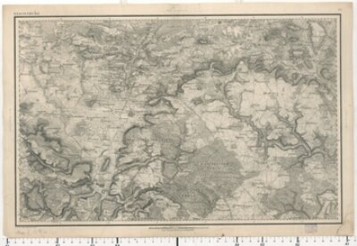
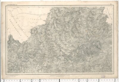
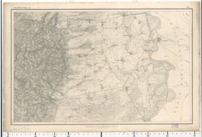
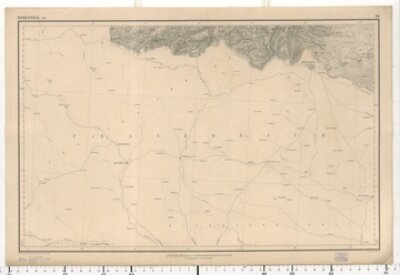
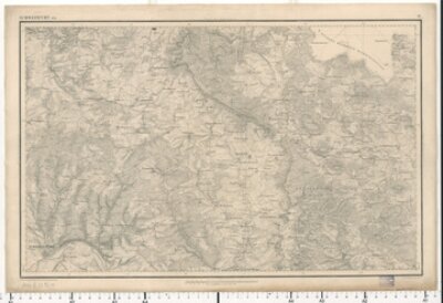
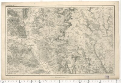
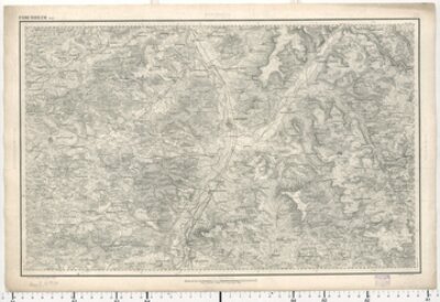
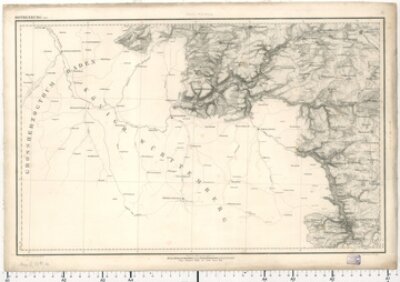
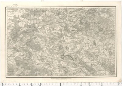
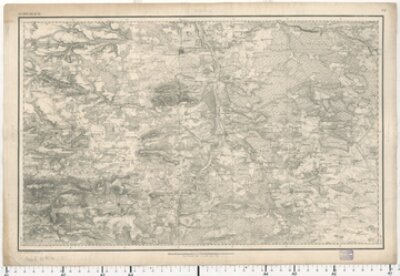
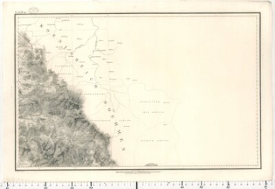
Topographischer Atlas 1:50 000, Blatt 100 Maedeler Gabel
- Blatt [100]: Maedeler Gabel
- Bayerische Staatsbibliothek
- Identifier: BV000453477
- Call number: Mapp. XI,57 du-100
- Topographisches Bureau
- 1830 - 1840
- München
- CC BY-NC-SA 4.0
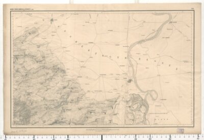
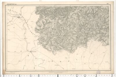
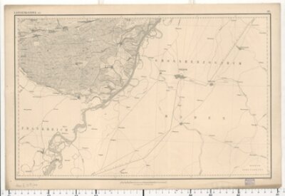
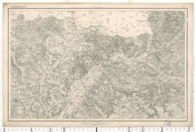
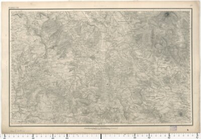
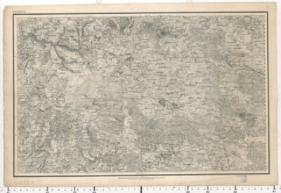
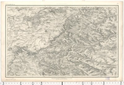
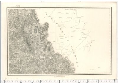
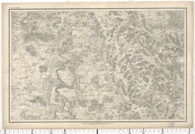
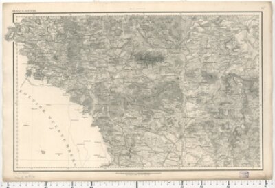
Topographischer Atlas 1:50 000, Blatt 101 Ebernburg
- Blatt 101: Ebernburg
- Bayerische Staatsbibliothek
- Identifier: BV017541929
- Call number: Mapp. XI,57 du-101
- Topographisches Bureau
- 1848
- München
- CC BY-NC-SA 4.0
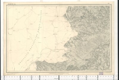
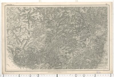
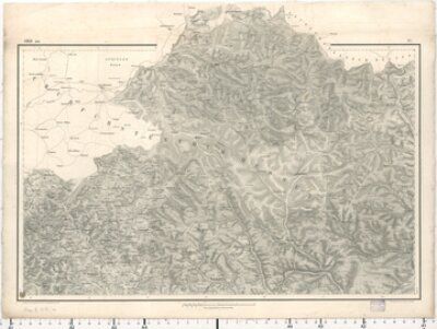
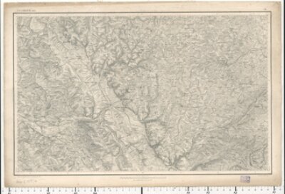
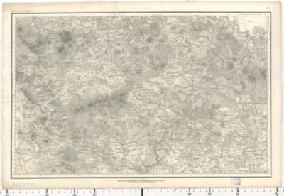
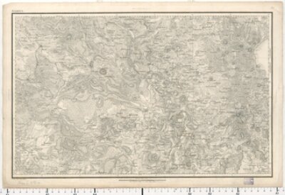
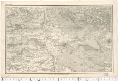
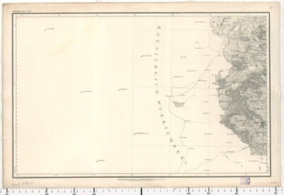
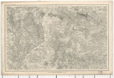
Topographischer Atlas 1:50 000, Blatt 102 Cusel
- Blatt 102: Cusel
- Bayerische Staatsbibliothek
- Call number: Mapp. XI,57 du-102
- Identifier: BV017541934
- Topographisches Bureau
- 1850
- München
- CC BY-NC-SA 4.0
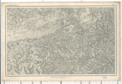
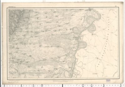
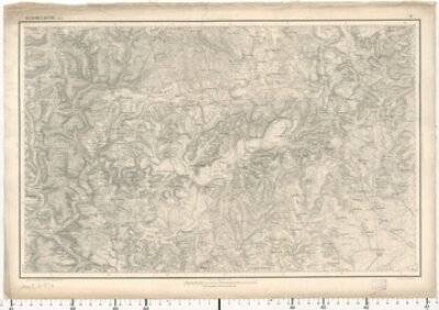
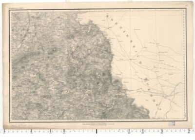
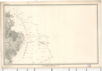
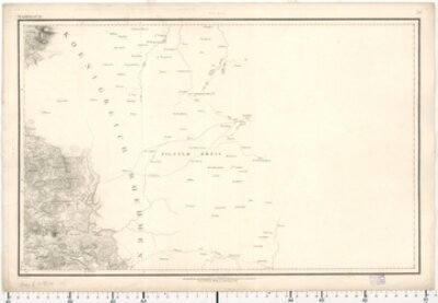
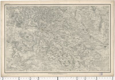
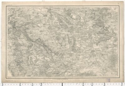
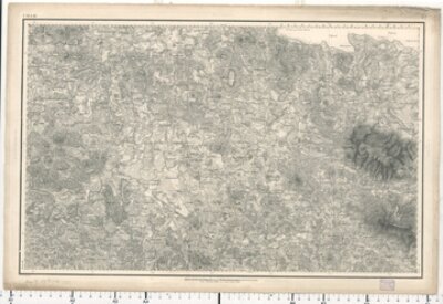
Topographischer Atlas 1:50 000, Blatt 103 Lauterecken
- Blatt 103: Lauterecken
- Bayerische Staatsbibliothek
- Call number: Mapp. XI,57 du-103
- Identifier: BV017541936
- Topographisches Bureau
- 1862
- München
- CC BY-NC-SA 4.0
Topographischer Atlas 1:50 000, Blatt 104 Kirchheimbolanden
- Blatt 104: Kirchheimboladen
- Bayerische Staatsbibliothek
- Identifier: BV017541938
- Call number: Mapp. XI,57 du-104
- Topographisches Bureau
- 1850
- München
- CC BY-NC-SA 4.0
Topographischer Atlas 1:50 000, Blatt 105 Homburg
- Blatt 105: Homburg
- Bayerische Staatsbibliothek
- Call number: Mapp. XI,57 du-105
- Identifier: BV017541940
- Topographisches Bureau
- 1856
- München
- CC BY-NC-SA 4.0
Topographischer Atlas 1:50 000, Blatt 106 Kaiserslautern
- Blatt 106: Kaiserslautern
- Bayerische Staatsbibliothek
- Identifier: BV017541942
- Call number: Mapp. XI,57 du-106
- Topographisches Bureau
- 1860
- München
- CC BY-NC-SA 4.0
Topographischer Atlas 1:50 000, Blatt 107 Frankenthal
- Blatt 107: Frankenthal
- Bayerische Staatsbibliothek
- Call number: Mapp. XI,57 du-107
- Identifier: BV017541947
- Topographisches Bureau
- 1861
- München
- CC BY-NC-SA 4.0
Topographischer Atlas 1:50 000, Blatt 108 Zweibrücken
- Blatt 108: Zweibrücken
- Bayerische Staatsbibliothek
- Call number: Mapp. XI,57 du-108
- Identifier: BV017541948
- Topographisches Bureau
- 1867
- München
- CC BY-NC-SA 4.0
Topographischer Atlas 1:50 000, Blatt 109 Pirmasens
- Blatt 109: Pirmasens
- Bayerische Staatsbibliothek
- Identifier: BV017541953
- Call number: Mapp. XI,57 du-109
- Topographisches Bureau
- 1867
- München
- CC BY-NC-SA 4.0
Topographischer Atlas 1:50 000, Blatt 110 Speyer
- Blatt 110: Speyer
- Bayerische Staatsbibliothek
- Call number: Mapp. XI,57 du-110
- Identifier: BV017541957
- Topographisches Bureau
- 1854
- München
- CC BY-NC-SA 4.0
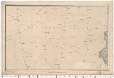
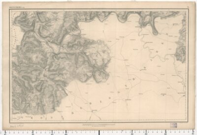
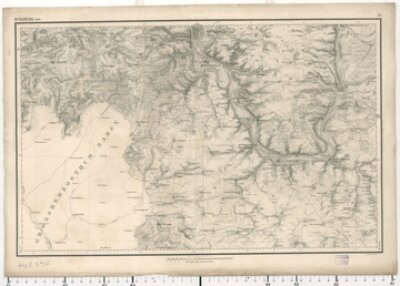
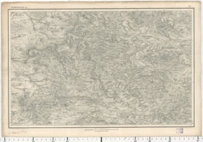
Topographischer Atlas 1:50 000, Blatt 111 Bobenthal
- Blatt 111: Bobenthal
- Bayerische Staatsbibliothek
- Identifier: BV017541958
- Call number: Mapp. XI,57 du-111
- Topographisches Bureau
- 1851
- München
- CC BY-NC-SA 4.0
Topographischer Atlas 1:50 000, Blatt 112 Langenkandel
- Blatt 112: Langenkandel
- Bayerische Staatsbibliothek
- Call number: Mapp. XI,57 du-112
- Identifier: BV017541959
- Topographisches Bureau
- 1850
- München
- CC BY-NC-SA 4.0
Topographischer Atlas 1:50 000, Blatt 10 Orb
- Blatt 10: Orb
- Bayerische Staatsbibliothek
- Call number: Mapp. XI,57 du-10
- Identifier: BV000453392
- Topographisches Bureau
- 1860
- München
- CC BY-NC-SA 4.0
Topographischer Atlas 1:50 000, Blatt 11 Hammelburg
- Blatt 11: Hammelburg
- Bayerische Staatsbibliothek
- Call number: Mapp. XI,57 du-11
- Identifier: BV000453393
- Topographisches Bureau
- 1853
- München
- CC BY-NC-SA 4.0
Topographischer Atlas 1:50 000, Blatt 12 Schweinfurt
- Blatt 12: Schweinfurt
- Bayerische Staatsbibliothek
- Call number: Mapp. XI,57 du-12
- Identifier: BV000453394
- Topographisches Bureau
- 1852
- München
- CC BY-NC-SA 4.0
Topographischer Atlas 1:50 000, Blatt 13 Lichtenfels
- Blatt 13: Lichtenfels
- Bayerische Staatsbibliothek
- Identifier: BV000453395
- Call number: Mapp. XI,57 du-13
- Topographisches Bureau
- 1867
- München
- CC BY-NC-SA 4.0
Topographischer Atlas 1:50 000, Blatt 14 Kulmbach
- Blatt 14: Kulmbach
- Bayerische Staatsbibliothek
- Call number: Mapp. XI,57 du-14
- Identifier: BV000453396
- Topographisches Bureau
- 1865
- München
- CC BY-NC-SA 4.0
Topographischer Atlas 1:50 000, Blatt 15 Marktleuthen
- Blatt [15]: Marktleuthen
- Bayerische Staatsbibliothek
- Call number: Mapp. XI,57 du-15
- Identifier: BV000453397
- Topographisches Bureau
- 1830 - 1840
- München
- CC BY-NC-SA 4.0
Topographischer Atlas 1:50 000, Blatt 16 Stockstadt
- Blatt 16: Stockstadt
- Bayerische Staatsbibliothek
- Call number: Mapp. XI,57 du-16
- Identifier: BV000453398
- Topographisches Bureau
- 1850
- München
- CC BY-NC-SA 4.0
Topographischer Atlas 1:50 000, Blatt 17 Aschaffenburg
- Blatt 17: Aschaffenburg
- Bayerische Staatsbibliothek
- Identifier: BV000453399
- Call number: Mapp. XI,57 du-17
- Topographisches Bureau
- 1859
- München
- CC BY-NC-SA 4.0
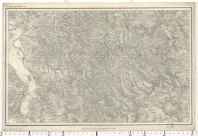
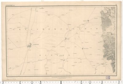
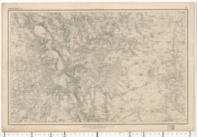
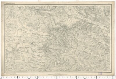
Topographischer Atlas 1:50 000, Blatt 18 Karlstadt
- Blatt 18: Karlstadt
- Bayerische Staatsbibliothek
- Call number: Mapp. XI,57 du-18
- Identifier: BV000453400
- Topographisches Bureau
- 1852
- München
- CC BY-NC-SA 4.0
Topographischer Atlas 1:50 000, Blatt 19 Gerolzhofen
- Blatt 19: Gerolzhofen
- Bayerische Staatsbibliothek
- Call number: Mapp. XI,57 du-19
- Identifier: BV000453401
- Topographisches Bureau
- 1857
- München
- CC BY-NC-SA 4.0
Topographischer Atlas 1:50 000, Blatt 20 Bamberg
- Blatt [20]: Bamberg
- Bayerische Staatsbibliothek
- Call number: Mapp. XI,57 du-20
- Identifier: BV000453402
- Topographisches Bureau
- 1841
- München
- CC BY-NC-SA 4.0
Topographischer Atlas 1:50 000, Blatt 21 Bayreuth
- Blatt [21]: Bayreuth
- Bayerische Staatsbibliothek
- Call number: Mapp. XI,57 du-21
- Identifier: BV000453403
- Topographisches Bureau
- 1830 - 1840
- München
- CC BY-NC-SA 4.0
Topographischer Atlas 1:50 000, Blatt 22 Tirschenreuth
- Blatt [22]: Tirschenreut
- Bayerische Staatsbibliothek
- Call number: Mapp. XI,57 du-22
- Identifier: BV000453404
- Topographisches Bureau
- 1830 - 1840
- München
- CC BY-NC-SA 4.0
Topographischer Atlas 1:50 000, Blatt 23 Mähring
- Blatt [23]: Mähring
- Bayerische Staatsbibliothek
- Call number: Mapp. XI,57 du-23
- Identifier: BV000453405
- Topographisches Bureau
- 1830 - 1840
- München
- CC BY-NC-SA 4.0
Topographischer Atlas 1:50 000, Blatt 24 Breitenbuch
- Blatt 24: Breitenbuch
- Bayerische Staatsbibliothek
- Call number: Mapp. XI,57 du-24
- Identifier: BV000453406
- Topographisches Bureau
- 1850
- München
- CC BY-NC-SA 4.0
Topographischer Atlas 1:50 000, Blatt 25 Miltenberg
- Blatt 25: Miltenberg
- Bayerische Staatsbibliothek
- Call number: Mapp. XI,57 du-25
- Identifier: BV000453407
- Topographisches Bureau
- 1850
- München
- CC BY-NC-SA 4.0
Topographischer Atlas 1:50 000, Blatt 26 Würzburg
- Blatt 26: Würzburg
- Bayerische Staatsbibliothek
- Call number: Mapp. XI,57 du-26
- Identifier: BV000453408
- Topographisches Bureau
- 1848
- München
- CC BY-NC-SA 4.0
Topographischer Atlas 1:50 000, Blatt 27 Scheinfeld
- Blatt 27: Scheinfeld
- Bayerische Staatsbibliothek
- Call number: Mapp. XI,57 du-27
- Identifier: BV000453409
- Topographisches Bureau
- 1855
- München
- CC BY-NC-SA 4.0
Topographischer Atlas 1:50 000, Blatt 28 Forchheim
- Blatt [28]: Forchheim
- Bayerische Staatsbibliothek
- Identifier: BV000453410
- Call number: Mapp. XI,57 du-28
- Topographisches Bureau
- 1846
- München
- CC BY-NC-SA 4.0
Topographischer Atlas 1:50 000, Blatt 29 Pegnitz
- Blatt [29]: Pegnitz
- Bayerische Staatsbibliothek
- Call number: Mapp. XI,57 du-29
- Identifier: BV000453411
- Topographisches Bureau
- 1830 - 1840
- München
- CC BY-NC-SA 4.0
Topographischer Atlas 1:50 000, Blatt 30 Weiden
- Blatt [30]: Weiden
- Bayerische Staatsbibliothek
- Call number: Mapp. XI,57 du-30
- Identifier: BV000453412
- Topographisches Bureau
- 1830 - 1840
- München
- CC BY-NC-SA 4.0
Topographischer Atlas 1:50 000, Blatt 31 Waidhaus
- Blatt [31]: Waidhaus
- Bayerische Staatsbibliothek
- Call number: Mapp. XI,57 du-31
- Identifier: BV000453413
- Topographisches Bureau
- 1830 - 1840
- München
- CC BY-NC-SA 4.0
Topographischer Atlas 1:50 000, Blatt 32 Rothenburg
- Blatt [32]: Rothenburg
- Bayerische Staatsbibliothek
- Call number: Mapp. XI,57 du-32
- Identifier: BV000453414
- Topographisches Bureau
- 1843
- München
- CC BY-NC-SA 4.0
Topographischer Atlas 1:50 000, Blatt 33 Windsheim
- Blatt [33]: Windsheim
- Bayerische Staatsbibliothek
- Call number: Mapp. XI,57 du-33
- Identifier: BV000453415
- Topographisches Bureau
- 1844
- München
- CC BY-NC-SA 4.0
Topographischer Atlas 1:50 000, Blatt 34 Nürnberg
- Blatt [34]: Nürnberg
- Bayerische Staatsbibliothek
- Call number: Mapp. XI,57 du-34
- Identifier: BV000453416
- Topographisches Bureau
- 1836 - 1845
- München
- CC BY-NC-SA 4.0
Topographischer Atlas 1:50 000, Blatt 35 Amberg
- Blatt [35]: Amberg
- Bayerische Staatsbibliothek
- Call number: Mapp. XI,57 du-35
- Identifier: BV000453417
- Topographisches Bureau
- 1830 - 1840
- München
- CC BY-NC-SA 4.0
Topographischer Atlas 1:50 000, Blatt 36 Pfreimt
- Blatt [36]: Pfreimt
- Bayerische Staatsbibliothek
- Call number: Mapp. XI,57 du-36
- Identifier: BV022429627
- Topographisches Bureau
- 1818
- München
- CC BY-NC-SA 4.0
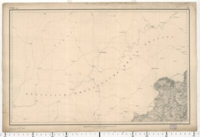
Topographischer Atlas 1:50 000, Blatt 37 Schönsee
- Blatt [37]: Schönsee
- Bayerische Staatsbibliothek
- Identifier: BV000453418
- Call number: Mapp. XI,57 du-37
- Topographisches Bureau
- 1830 - 1840
- München
- CC BY-NC-SA 4.0
Topographischer Atlas 1:50 000, Blatt 38 Obergailnau
- Blatt [38]: Obergailnau
- Bayerische Staatsbibliothek
- Identifier: BV000453419
- Call number: Mapp. XI,57 du-38
- Topographisches Bureau
- 1830 - 1840
- München
- CC BY-NC-SA 4.0
Topographischer Atlas 1:50 000, Blatt 39 Ansbach
- Blatt [39]: Ansbach
- Bayerische Staatsbibliothek
- Identifier: BV000453420
- Call number: Mapp. XI,57 du-39
- Topographisches Bureau
- 1830 - 1840
- München
- CC BY-NC-SA 4.0
Topographischer Atlas 1:50 000, Blatt 40 Schwabach
- Blatt [40]: Schwabach
- Bayerische Staatsbibliothek
- Identifier: BV000453421
- Call number: Mapp. XI,57 du-40
- Topographisches Bureau
- 1830 - 1840
- München
- CC BY-NC-SA 4.0
Topographischer Atlas 1:50 000, Blatt 41 Neumarkt
- Blatt [41]: Neumarkt
- Bayerische Staatsbibliothek
- Identifier: BV000453422
- Call number: Mapp. XI,57 du-41
- Topographisches Bureau
- 1830 - 1840
- München
- CC BY-NC-SA 4.0
Topographischer Atlas 1:50 000, Blatt 42 Burglengenfeld
- Blatt [42]: Burglengenfeld
- Bayerische Staatsbibliothek
- Identifier: BV000453423
- Call number: Mapp. XI,57 du-42
- Topographisches Bureau
- 1830 - 1840
- München
- CC BY-NC-SA 4.0
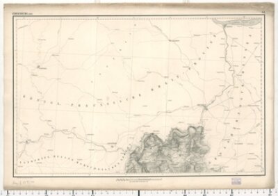
Topographischer Atlas 1:50 000, Blatt 43 Cham
- Blatt [43]: Cham
- Bayerische Staatsbibliothek
- Call number: Mapp. XI,57 du-43
- Identifier: BV000453424
- Topographisches Bureau
- 1830 - 1840
- München
- CC BY-NC-SA 4.0
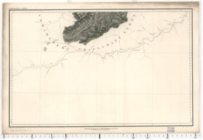
Topographischer Atlas 1:50 000, Blatt 44 Lam
- Blatt [44]: Lam
- Bayerische Staatsbibliothek
- Call number: Mapp. XI,57 du-44
- Identifier: BV008269966
- Topographisches Bureau
- 1824 - 1826
- München
- CC BY-NC-SA 4.0
Topographischer Atlas 1:50 000, Blatt 45 Dinkelsbühl
- Blatt [45]: Dinkelsbühl
- Bayerische Staatsbibliothek
- Identifier: BV000453426
- Call number: Mapp. XI,57 du-45
- Topographisches Bureau
- 1830 - 1840
- München
- CC BY-NC-SA 4.0
Topographischer Atlas 1:50 000, Blatt 46 Weissenburg
- Blatt [46]: Weissenburg
- Bayerische Staatsbibliothek
- Identifier: BV000453427
- Call number: Mapp. XI,57 du-46
- Topographisches Bureau
- 1830 - 1835
- München
- CC BY-NC-SA 4.0